Nisqually Entrance
Paradise from Tacoma
The southwest approach serves Longmire and Paradise.
Route context: Tacoma to SR 7, then SR 706 toward the Nisqually Entrance; continue on park roads to Longmire and Paradise.
Checked Sep 16, 2026
Gateway to Mount Rainier
Planning a day at Mount Rainier? Start with Tacoma Trekker.
Mount Rainier National Park is outside Tacoma. This independent guide helps Tacoma visitors plan the journey without claiming an official gateway designation.
No timed entry required in 2026
NPS announced that Mount Rainier will not require timed-entry reservations in 2026. An entrance pass is still required. Recheck official guidance for future years or policy changes.
Read the NPS announcementA regional view for orientation. Use live directions for traffic and verify park roads before departure.
Tacoma → Mount Rainier
Choose an area below, then open live directions and official road conditions before departure.
Plan your drive
Entrances do not connect equally in every season. Pick your destination, then check the matching entrance and official road status.
Nisqually Entrance
The southwest approach serves Longmire and Paradise.
Route context: Tacoma to SR 7, then SR 706 toward the Nisqually Entrance; continue on park roads to Longmire and Paradise.
Checked Sep 16, 2026
White River Entrance
The northeast approach uses SR 410 and the White River Entrance when access is open.
Route context: Tacoma toward SR 410, then the White River Entrance and Sunrise Road when open.
Checked Sep 16, 2026
Stevens Canyon Entrance
The southeast park area is reached through seasonal road connections.
Route context: Use an official route planner and verify SR 123 and Stevens Canyon Road status before travel.
Checked Sep 16, 2026
Carbon River Entrance
This northwest area does not currently offer normal vehicle access from SR 165.
Checked Sep 16, 2026
Prepare in Tacoma, then recheck official information on the day you travel.
Mount Rainier weather, roads, parking, facilities, fire conditions, trail access, and seasonal operations can change quickly. Download official maps and essential trip information before leaving reliable service. The park is cashless, and a Washington Discover Pass does not cover national park entrance fees.
The National Park Service reports very little cell service throughout the park and warns that GPS is not reliable. Paradise is the only area described in the park accessibility guide as having consistent coverage. Download offline maps, directions, passes, reservations, and essential trip details before leaving Tacoma.
Bring water, food, layers, rain protection, appropriate footwear, sun protection, offline navigation, a charged phone and power bank, and any required entrance pass, camping reservation, or wilderness permit. NPS recommends the Ten Essentials for hikes; this checklist does not replace official park safety guidance.
Current conditions
Live summaries come from official NPS and NWS feeds and expire after 30 minutes. Open the official source before departure because conditions can change faster than any guide.
Tonight: Partly Cloudy, 39°F. Mountain conditions vary sharply by elevation.
6 current NPS alerts found. Read each applicable notice before travel.
Current NPS alerts mention road, entrance, parking, bridge, or pass access. Confirm the full road-status map and WSDOT conditions.
Current NPS alerts include trail, fire, backcountry, or closure notices. Match them to your chosen area.
Major developed areas, each with a different entrance, elevation, season, and visitor experience.

Via Nisqually (SR 706)
Reflection Lakes sit along Stevens Canyon Road between Paradise and Ohanapecosh. The road section is seasonal and typically closed by snow in winter and spring, so confirm road status before planning a stop.
Checked Sep 16, 2026

Via SR 410 (east side)
Tipsoo Lake is reached from SR 410 near Chinook Pass. WSDOT closes Chinook Pass seasonally, so this area is only reachable when the highway is open, generally in summer and early fall.
Checked Sep 16, 2026

Via Mowich (unpaved)
Mowich Lake Road is unpaved and opens later in the season than paved park roads, typically in summer once snow clears. Services are extremely limited. Check the park road status page for the current opening.
Checked Sep 16, 2026

Via Carbon River
The road beyond the Carbon River Entrance is closed to private vehicles and is used as a trail for walking and biking. Plan for a rainforest environment, wet trail conditions, and no visitor services.
Checked Sep 16, 2026

Via Nisqually Entrance
Longmire offers a museum, historic district and visitor information; check current lodging and dining operations.
Checked Sep 16, 2026

Via Nisqually Entrance
Paradise is reached from the Nisqually Entrance and includes the park’s main visitor center. Verify current operations and road status.
Checked Sep 16, 2026

Via White River Entrance
Sunrise offers broad views and high-country trail access in its normal season. Check current conditions before choosing it.
Checked Sep 16, 2026

Via Stevens Canyon Entrance
Ohanapecosh is substantially seasonal. Verify road, campground, visitor-center, parking, and construction status.
Checked Sep 16, 2026
Ranger information, exhibits, and restrooms. Opening days and hours change by season, so confirm with the National Park Service before you drive up.

Paradise · Via Nisqually Entrance (SR 706)
Exhibits, ranger information, a park film, restrooms and seasonal food service at Paradise. Opening days and hours change by season, so check the NPS visitor centers page before you drive up.
Checked Sep 16, 2026

Sunrise · Via White River Entrance (SR 410)
Ranger information and exhibits at the highest point you can drive to in the park. Sunrise is a summer destination: the visitor center is open only while Sunrise Road is open, typically from early summer into fall.
Checked Sep 16, 2026
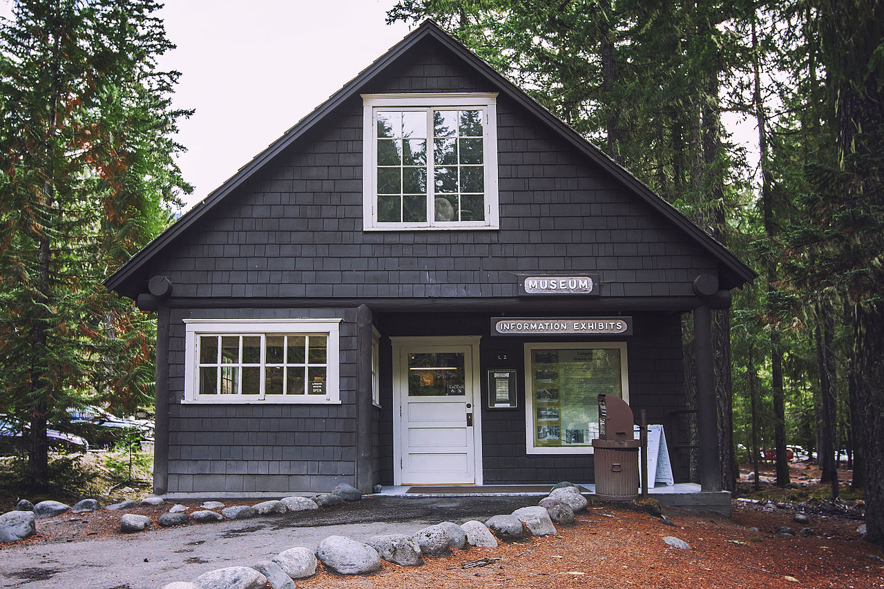
Longmire · Via Nisqually Entrance (SR 706)
Park history and natural history exhibits plus ranger information in the Longmire historic district, reached by the year-round Nisqually Entrance road. Hours vary by season; the nearby wilderness information desk handles backcountry permits in season.
Checked Sep 16, 2026
Only source-backed trail details are shown. Check current trail conditions, snow, bridges, and closures.

This loop begins near Tipsoo Lake on the park's east side. Snow lingers into summer at this elevation and the access highway closes seasonally, so confirm both trail and highway status.
Checked Sep 16, 2026

The trailhead is on Stevens Canyon Road, which is seasonal. The route rolls over benches with roots and rocky footing rather than staying level.
Checked Sep 16, 2026

This is the introductory walk at Sunrise, gaining a ridge above the parking area. Sunrise is the highest point reachable by vehicle in the park and opens late in the season.
Checked Sep 16, 2026
The trail leaves the Sunrise area and stays relatively level, making it one of the easier high-elevation options once Sunrise is open for the season.
Checked Sep 16, 2026

A brief introduction to the park's inland temperate rainforest, close to the entrance parking area. Expect wet, mossy conditions much of the year.
Checked Sep 16, 2026

Trail status, snow cover, and accessibility can change. Check current trail and Paradise conditions before setting out.
Checked Sep 16, 2026

Check Longmire access and current trail conditions. Seasonal snow, storms, and maintenance can affect the route.
Checked Sep 16, 2026

NPS describes this as a short loop through old-growth forest. Check current trail and road conditions before departure.
Checked Sep 16, 2026

NPS lists this route as one mile round trip and about 35 minutes. Snow, meadow protection, and current trail conditions can change the experience.
Checked Sep 16, 2026

NPS lists this loop at 4.6 miles and about 2.5 hours. It is a more active option; check current trail, bridge, snow, and weather conditions.
Checked Sep 16, 2026

For 2026, NPS says Silver Falls is accessible from the Grove of the Patriarchs parking area as a one-mile out-and-back with about 300 feet of elevation change. It cannot be hiked as the usual campground loop. Recheck the current Ohanapecosh trail notice.
Checked Sep 16, 2026
Season is a planning factor, not a guarantee. Always check the day’s weather and access.
Spring
Spring: lower-elevation forest walks near Longmire and Carbon River open first, while Paradise and Sunrise remain snowbound. Seasonal roads including Stevens Canyon, Mowich Lake, and the mountain passes are usually still closed.
Checked Sep 16, 2026
Summer
Summer: the most park areas are reachable, including Paradise, Sunrise, Ohanapecosh, and east-side approaches over Chinook and Cayuse passes once WSDOT reopens them. Parking at Paradise and Sunrise fills early on clear weekends, and subalpine snow can linger into July.
Checked Sep 16, 2026
Fall
Fall: color moves through the subalpine meadows early, then the forest valleys. Seasonal roads and higher facilities begin closing with the first sustained snow, so access can change week to week.
Checked Sep 16, 2026
Winter
Winter: the Nisqually Entrance and the road to Longmire are open year round, and the road from Longmire to Paradise is plowed but gated overnight and closed during storms. Tire chains must be carried when the Paradise road is open in winter. Check the park road status page the morning you travel.
Checked Sep 16, 2026
Make Tacoma your base
Choose from the existing published Tacoma directory. These are editorial links, not claims of partnership, availability, or preferential placement.
A full day from a Tacoma hotel and breakfast, over the year-round Nisqually Entrance road to Longmire and Paradise, with a seasonal Reflection Lakes stop and dinner back in Tacoma. Park details come from the National Park Service; Tacoma stops are editorial suggestions, not partnerships or reservations.
Stay the night in downtown Tacoma
Night before
Base yourself in downtown Tacoma the night before so you can leave early. Other published downtown options: McMenamins Elks Temple and Silver Cloud Hotel Tacoma – Waterfront. Editorial suggestion only — book directly and confirm rates yourself.
Breakfast and coffee before the drive
Early morning
Coffee and something to eat before the drive. Other published options: Bluebeard Coffee Roasters, Shakabrah Java, and Valhalla Coffee Co. Check current hours with the business.
Drive to the Nisqually Entrance
Morning
Drive south and east to the Nisqually Entrance near Ashford, the park's only year-round entrance. An entrance fee or pass is required. Confirm road status with the National Park Service on the morning you travel.
DirectionsLongmire: history and a forest walk
Late morning
Stretch your legs in the Longmire historic district: the Longmire Museum, and the short Trail of the Shadows loop across the road. Twin Firs Loop is a few minutes back down the road for old-growth forest.
DirectionsParadise: meadows and mountain views
Midday to afternoon
The centrepiece of the day: the Henry M. Jackson Memorial Visitor Center, subalpine meadows, and short walks such as Nisqually Vista or Skyline to Myrtle Falls. Snow can linger into summer, and parking fills on clear weekends.
DirectionsReflection Lakes on the way out (seasonal)
Late afternoon
When Stevens Canyon Road is open, Reflection Lakes is a short stop below Paradise with a classic mountain-and-water view. This section is seasonal: check the National Park Service road status before counting on it, and simply return the way you came if it is closed.
DirectionsDinner back in Tacoma
Evening
Come back down to Tacoma for dinner. Other published options: Asado Cocina Argentina, Dirty Oscar's Annex, and Katie Downs Waterfront Tavern. Editorial suggestions, not partnerships — confirm hours before you arrive.
Full-day Trek
Full day (12 to 14 hours from Tacoma) — a Tacoma stay and breakfast, the year-round Nisqually drive, then the park. It is a plan, not a reservation or a guarantee of access.
Open the full TrekChoose a season and activity level for a practical, source-backed day outline.
Choose a season, activity level, and interest. The builder uses only current, published guide records.
Rainier Trekker
Prefer to browse? Search park areas and hikes the same way you browse Tacoma places.